Dear diary, we paddled more places than we expected in 2024. (Fox River (Wisconsin), Six Mile Creek, Starkweather Creek, Turtle Creek, Yahara River, Rock River, Waubesa Wetlands, and Mirror Lake.) Our friend took off work one afternoon every other week in order to be on the water. Below is a list of where we went since we are not being efficient at writing individual blogs.
2024 was a year of many rainstorms. Wisconsin finally is out of its drought. The water levels are high. To select where to paddle, we took into account the high water levels, the timeframe constraints, and whether we needed to paddle against the current or not.
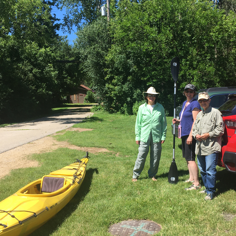
We’re not getting any younger. Because of our body mechanics (back / knee issues), Mary and I had to develop a new way to manage the canoe on and off the car. Our idea worked out well, and we are no longer so nervous about it. We are confident now, but we were grateful to have friends with us on these paddles just in case we got into trouble.
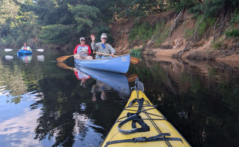
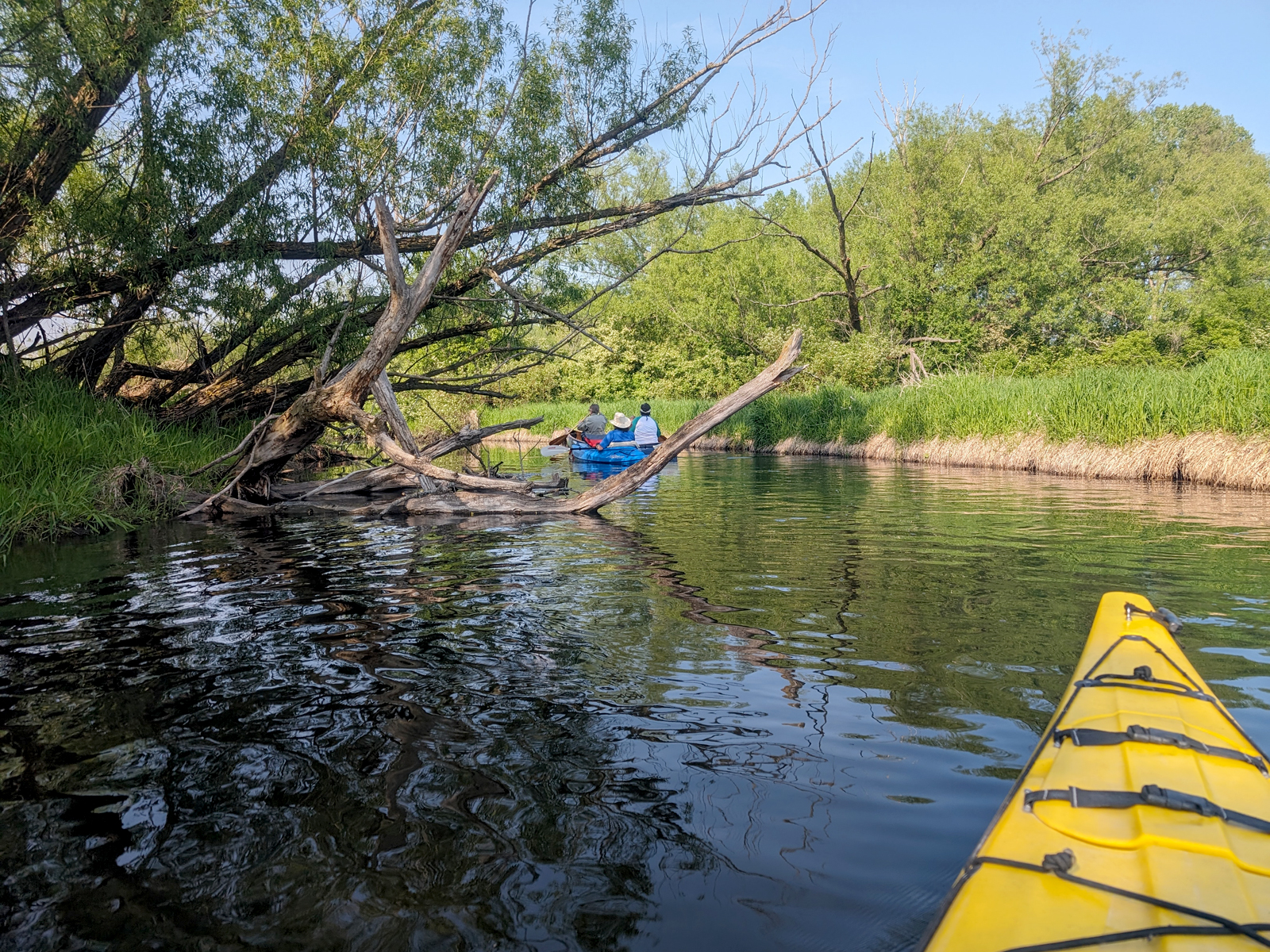
Six Mile Creek: Lake Mendota to downed tree
05/16/2024 – Paddle 1
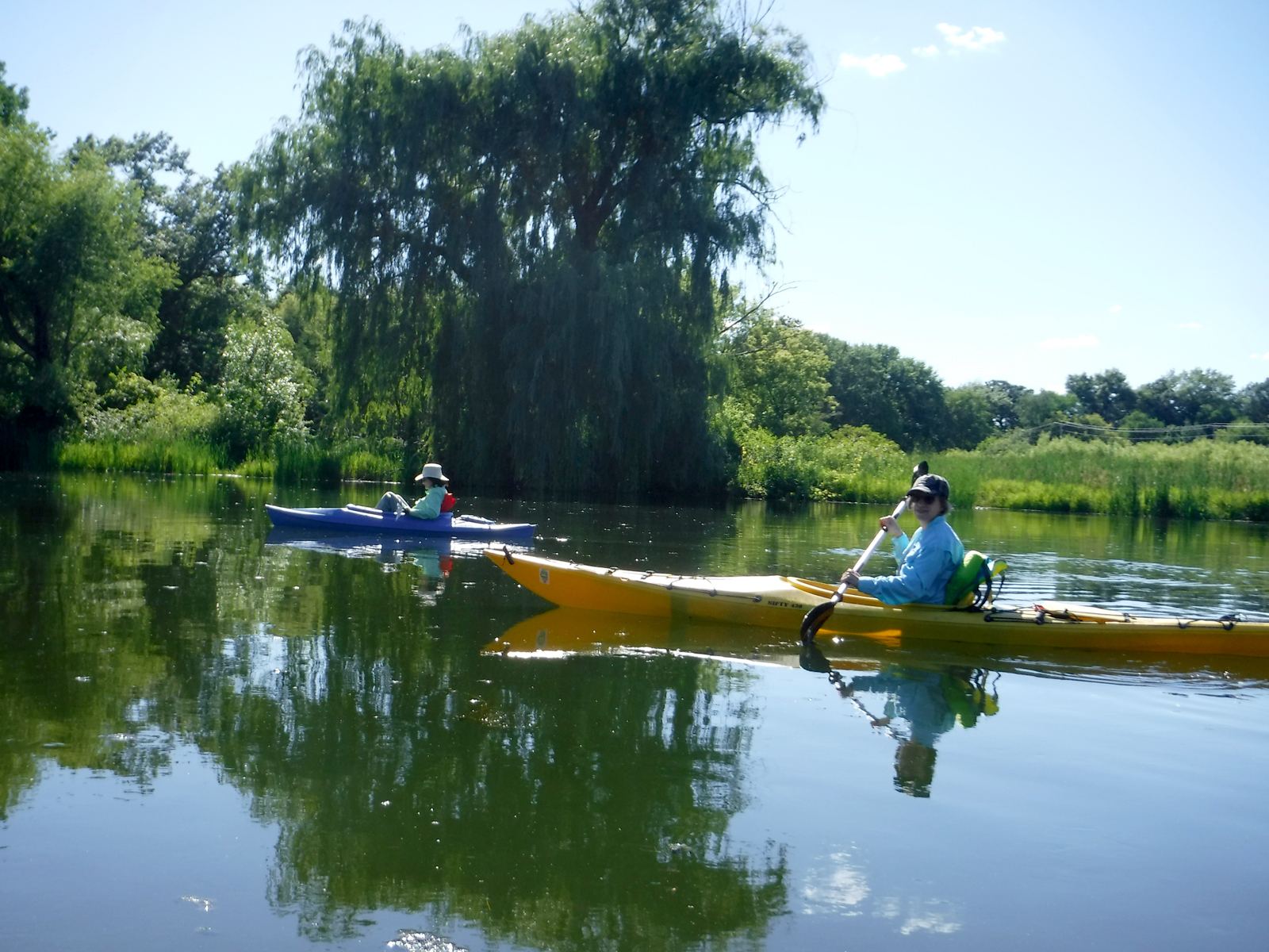
Our friend Katia decided to arrange her work schedule so she could get more paddling in this year. This was our first of many 2024 paddles taking advantage of her availability. It’s always nice to start the season off with a nearby paddle in case we forget something or just don’t have our routine set. Mary and I had to figure out a new way to take the canoe on and off the car because of our body mechanic issues. Seemed to work out a-ok.
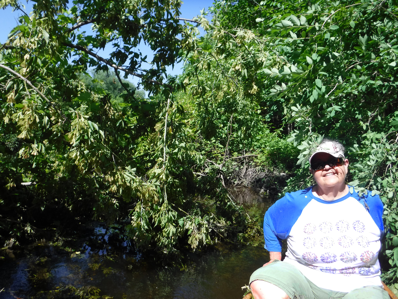
On this paddle, we enter at the big boat ramp in Governor Nelson State park. Follow the bank left to get into a marshy area, then under the M bridge get into the beautiful Six Mile Creek. It is too bad it is such a long way to get to the prettiest part of the paddle. There is a Friends of Six Mile Creek group that is working to improve the paddle-ability. On this day a downed tree prevented our the canoe from going further – the kayaks were able to get around it. This might be cleared by now. We really need to do reconnaissance to find out the different entry/exit points.
wildlife: birds, Baltimore oriole, heron, cranes, fish
Itinerary (per time screenshots)
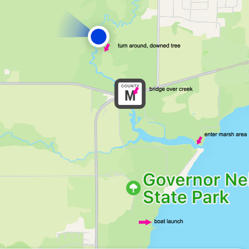 2:45 Drive to Gov Nelson Park
3:07 Arrive at Lake Mendota boat launch
unload / park cars
3:22 Launch into lake
3:49 Enter into marsh
4:10 Go under bridge enter Six Mile Creek
4:50 Turn around at downed tree
6:22 Take out
For photos, see our previous paddles of Six Mile Creek
Starkweather Creek: Olbrich Park to Golf Course
05/30/2024 – Paddle 2
No friends were available to paddle with us so we ventured out on our own. We started at the Olbrich Park launch (across from Olbrich Garden) and paddled about half way through Bridges golf course. We had had a lot of rain, and the water was about as high as we’d like to paddle upstream.
We did meet another kayaker on the way upstream. We asked about obstructions and he was very obtuse with the answer. There were indeed some challenges getting around downed tree branches, and in the end that’s what stopped us from going further. It was fun and pretty.
wildlife: ducks, lots of turtles, cranes
itinerary – about a 2 hour paddle round trip
For photos, see our previous paddles of Starkweather Creek
Yahara River: Jaeger Park to Fish Camp
06/30/2024 – Paddle 3
This is such a relaxing paddle on the Yahara River and it is very close to Madison. On this day there were a lot of detours on the shuttle route due to road construction. Most of the dredging equipment has been removed from the river, although there were still some floating pipes downstream. Jeanne had not been on this route before, and that always makes it fun for us.
 wildlife: birds, swallows, ducks, damsels and dragonflies
water level: Gauge at McFarland 05429500 ~670 (median ~170) Low or high water levels don’t seem to matter much on this stretch.
itinerary: round trip door to door was about 3 hours
For photos and more info, see our previous paddles of Yahara River
Yahara River: LaFollette Park to Viking Park (first time)
07/10/2024 – Paddle 4
I hope to pull this one out into its own blog because it was our first time.
The Launch:
Put in at LaFollette Park to the south of Lake Kegonsa Lock and Dam (2240 Williams Dr, Stoughton). This is in the north portion of LaFollette park in Stoughton but we didn’t have time to explore the rest of it. It’s a popular fishing area which is a nice enough launch but not much room for cars to maneuver. It will depend on how many people were already there. We did ok with two cars. After the shuttle, we parked the car in the north parking lot which seemed to be much less busy and is a larger area.
While Mary and Katia shuttled to Viking Park (1583 County Hwy N), Deb explored the other side of the dam to see if it would be easier to launch from there in the future. That side was steeper and had big rocks that wouldn’t be too great for a Kevlar canoe. She talked to a nice fisherman there who lives in the area. He assured me that there will be no problem with grounding. They saw a bird she thought was a green heron, but he pointed out that it was an American bittern.
Back to waiting on the other side to launch, she was subjected to two old guys singing the praises of Donald Trump – ugh!
The Shuttle:
The shuttle was to Viking Park, Stoughton and it was about 15 min round trip. (Williams Drive south to County Highway B)
The Paddle:
It starts out in a beautiful area next to the dam on the right. There was not much water coming through the dam which would be a big factor if it was more active. The river could be a bit confusing, but we had read that we should “keep right and you won’t get lost”. That advice was great until the end when the Yahara River was lake-like and we really needed to go left to find the channel to Viking Park.
(add: route map)
We enjoyed a nice little current because the water was much higher than normal.
The Take Out:
Viking Park has a large take-out area, but also, around the bend there is a smaller less-steep one that our kayaking friend found easier to use to disembark. While Katia and Mary were shuttling, Deb’s sciatic pain kicked in – it was terrible and memorable. Our new method of taking the boat off / on the car seems to work ok. Time will tell.
wildlife: birds, blue heron, American bittern, kingfisher, fish, frogs
water levels: Gauge at Stoughton 05429700 ~920 cfs (Median approx 300 cfs) This stretch of the Yahara is probably paddleable at any level.
Itinerary
2:25 pick up Katia
2:37 drive to Lafollete Park
3:00 arrive / park / unload
3:15 shuttle 15 min (Williams Dr south to CTH B)
3:45 paddle 1:20 paddle
5:05 shuttle 15min
5:20 pack up
5:45 drive
6:15 home
For more photos, see our previous paddles of Viking Park
Fox River, Princeton: Dam to St Marie Road
07/24/2024 – Paddle 5
I hope to pull this one out into its own blog because we have some great photos and lots of stories.
We were excited to introduce our friends to this paddle – for them it was the first time.
The Launch:
After using the porta-potty (gross) at the other end of the dam, everyone but me worked on shuttling two cars to the take out. Meanwhile I talked to two very chill fishermen on the bank. I turned down their very kind offer of a cold bottle of water then they were willing to talk to me about the area and fishing. I watched one of the guys catch and release two fish. One was a bluegill, and the discussion of bluegill – how to catch them and cook them – was an elaborate one. I then got a strong craving for fish fry that we eventually satisfied the following Friday night – we have a restaurant nearby that serves bluegill.
When they returned we got ready to launch. We always help our kayaking friends get into the water first, and then we launch our own canoe. We pushed Katia into the water (by we, I mean Mary) and then Jeanne was in the kayak, nose in the water when she said “I don’t have a paddle!”. She had forgotten it in her car which was at the take out. So we pulled out Jeanne, pulled out Katia, and they did the shuttle over again. We assured Jeanne that we, too, have made every mistake in the book! Launch #2 went as smooth as can be.
The Paddle
When we started off the first thing that happened was we saw a pair of eagles – one mature and one a youngster. The adult flew off but we got to ogle the young eagle and get some photos. Seeing eagles is more common than it used to, but it is still a thrill.
The water was very pretty that day. It was quiet and reflective. The sky was blue with big white fluffy clouds – really quite beautiful. We had a bit of a current because recent rain made it 3x the median cfs – nice!
This paddle has several “points of interest” as we call them: the “ice cream bridge”, the park with alternately-abled paddle craft launch, a bridge that has a big gear under it because it used to rotate to let big boats through, the “crooked house”, and a little cabin with a red roof that is so close to (and sometimes “in”) the water that we wonder if it will still be there. It was! (I hope to add photos of all of this).
The beginning of the paddle feels pretty remote although there are some homes along the banks. We saw herons and at one point a heron was standing on a post / tree so still we thought it was a statue. There’s a photo of Katia floating by it.
Right after this incident and just as we saw the first building of the (city?) town of Princeton, a carillon started playing. First is was 6 bongs announcing the time 6:00 but that was followed by many hymns played on the bells. It was really fantastic and timed so serendipitously it seemed the bells were hailing our arrival.
After a bit of paddling, just before the “ice cream bridge” we heard rock-and-roll music coming from a new-to-us bar/bbq establishment. Some guy came up to encourage us to get out and join the fun, but we did need to get out before sunset – still, it was very jolly.
I don’t know why seeing the little cabin with the red roof makes me so happy that it exists. It was still there, and we paddled right up to it. There is a sign over the door “Franke’s on the Fox”.
At the end, the take out always surprises us because it is well hidden until you are right on it.
wildlife: eagles, heron, cedar waxwing and kingfisher
water levels: Gauge at Princeton 04073365 ~1920 cfs (median ~ 600)
this was our draft itinerary:
2:00 – depart
3:15 – arrive at dam put-in, shuttle 15min, unload
3:45 – launch, paddle
5:45 – take out, shuttle, pack up
6:30 – drive
7:45 – home
For photos and more details, see our previous paddles of Fox River
Fox River: O Bridge to Endeavor
08/07/2024 – Paddle 6
Most of this paddle is through a wildlife area, and there is precious little shade. This summer we experienced bouts of weather in the 70’s and that’s why we decided this would be the perfect time to introduce this stretch to Jeanne. Last year we paddled with Katia from Endeavor but didn’t have time to do the shuttle. so she got to experience the full swath of river too.
When we were unloading (no facilities on either end by the way), a man pulled up and said that he was just curious about how the water levels were. I guess it seemed strange because he said he lived nearby and just happen to check on things while we were there – it sure seemed like he was more likely checking up on who we were. Nothing nefarious happened though. In fact, he helped Katia get her kayak off her car.
While I was waiting for them to shuttle the cars, I saw a nice frog hanging around. Also there were tons of little tiny fish (I guess they could have been tadpoles) hanging out in the very shallow water.
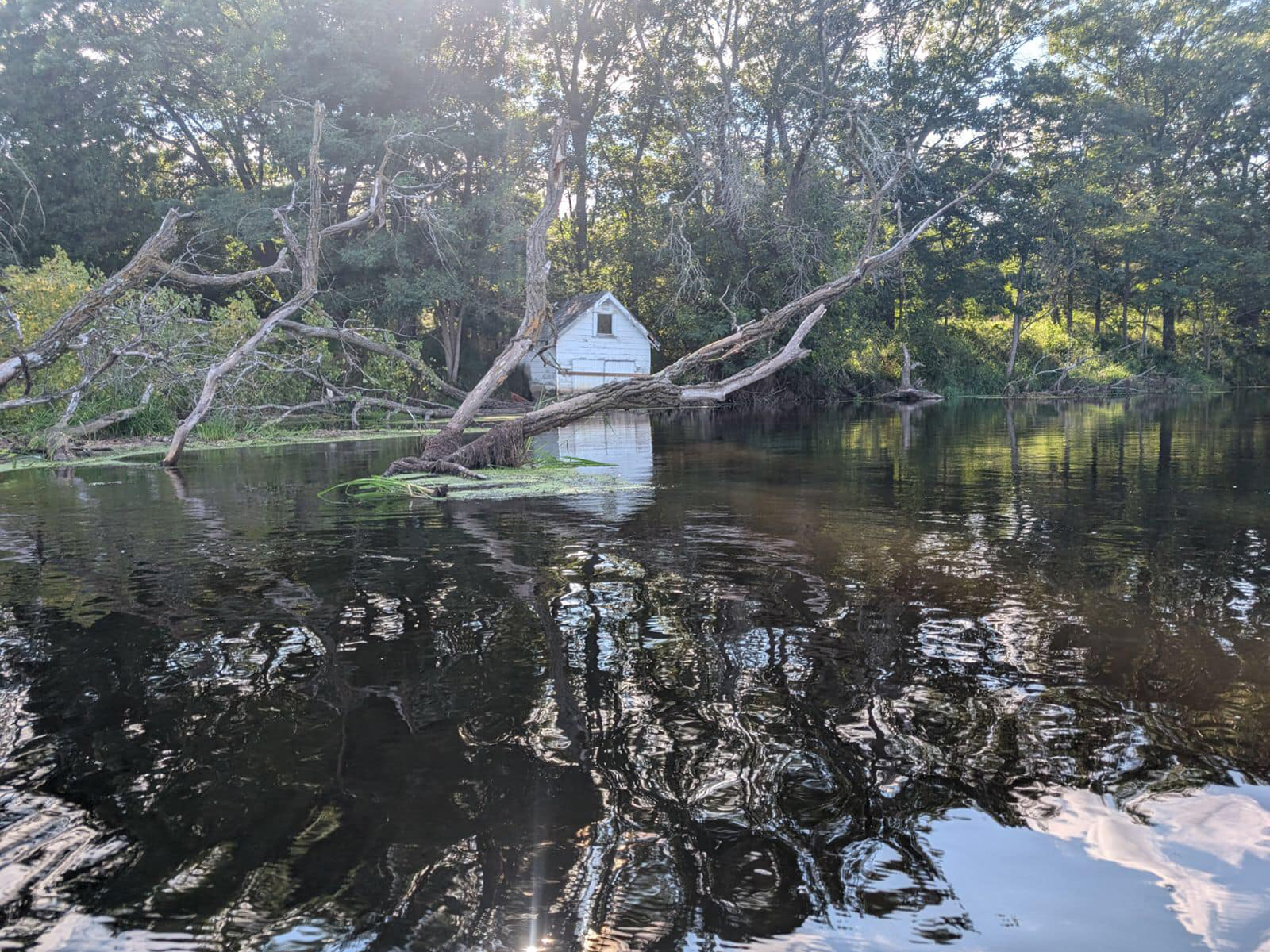
It was a pretty day and the water was very reflective. We have a lot of beautiful pictures. We were so happy to see that the little white boathouse was still standing. It definitely was looking older but it is the most prominent point-of-interest on this paddle.
wildlife: frogs, little tiny fish at put-in, birds, redwing blackbirds, heron, cranes
water level: gauge at Princeton 1290 cfs
Itinerary
2:00 Drive (via 26 due to 51 under construction)
3:00 Arrive O Bridge unload
3:20 Shuttle to Endeavor (25 min)
3:45 Launch / Paddle
5:45 Take out at Endeavor
6:10 Shuttle (25 min)
6:35 Drive
7:35 home
For photos, see our previous paddles of Fox River
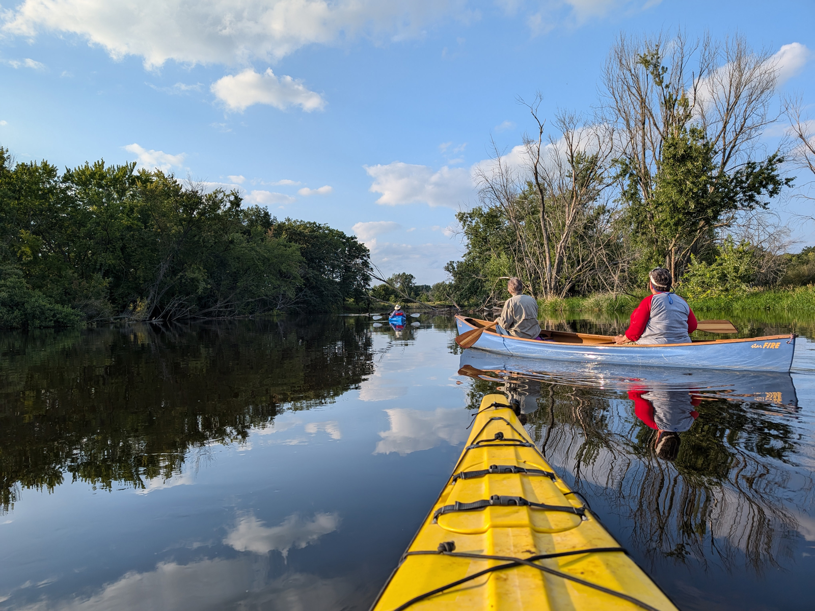
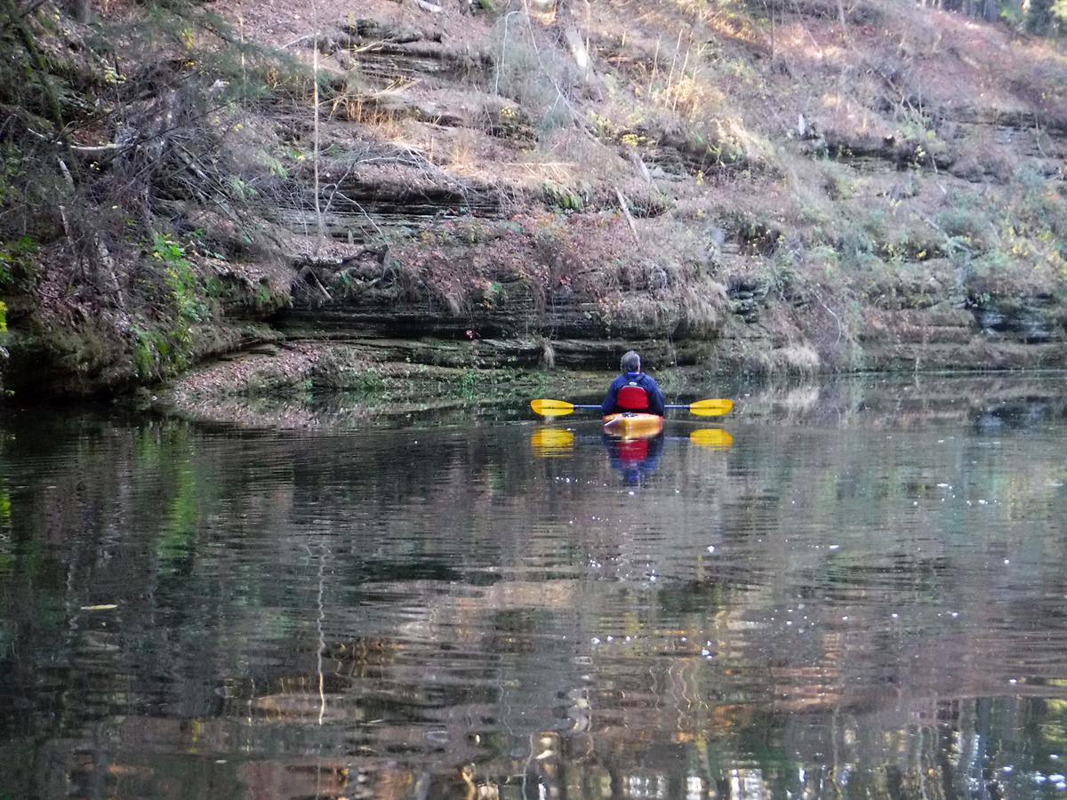
Turtle Creek: 140 to Tiffany Bridge
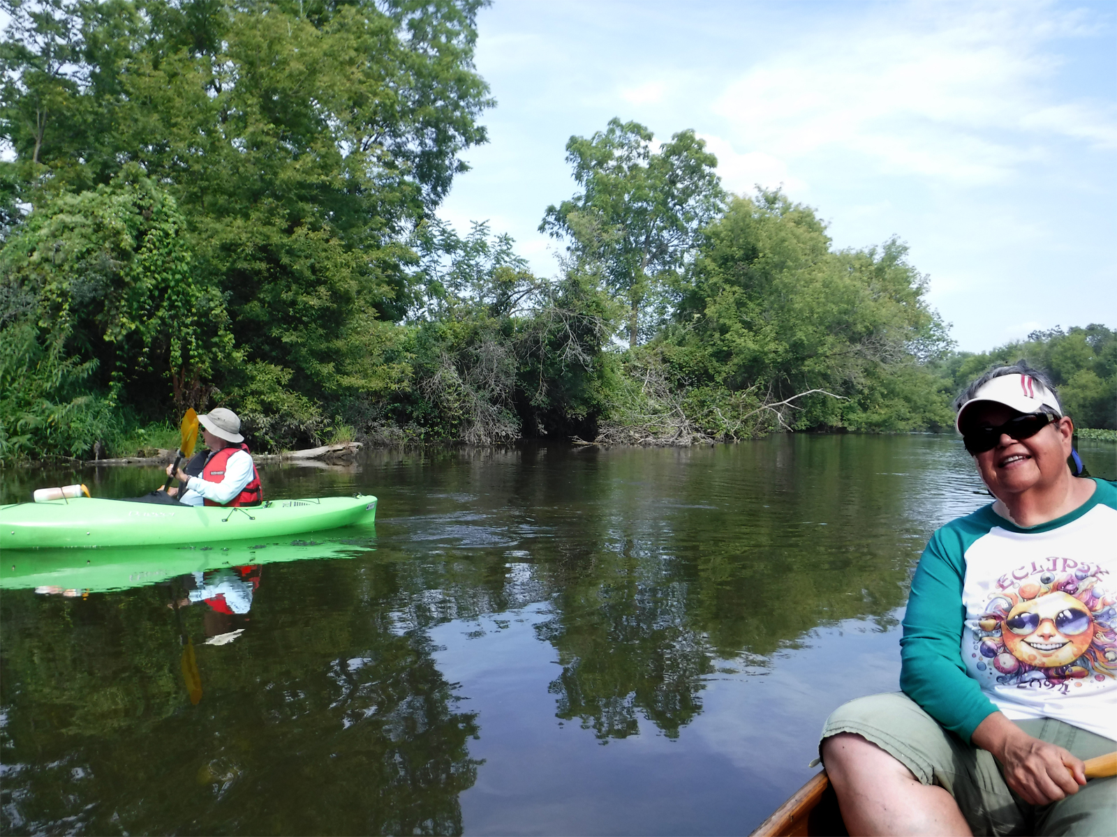
08/14/2024 – Paddle 7
It was fun to introduce Turtle Creek to Steve since he grew up in Wisconsin but had never been on this stream. This was our first paddle with him and we found that we are very compatible. This paddle was about 3.75 miles and everything went smoothly. We did ground out once in the canoe but it could have been avoided if we had kept to the edges. Mary got us going again. She stepped into the water to pull us out – she claimed it was refreshing.
The water was very clear and we saw quite a few fish. There weren’t very many invasive plants in this stretch so the stream seems really healthy. We started by going up stream for about 10 minutes just to see what there is to see. People have reported to us that the stretch Carver’s Rock to 140 is their favorite / prettiest stretch but it must be farther up.
 When we got off the stream there was a father and adult daughter exiting. He was having a lot of trouble securing an old beat-up boat onto the top of a truck but he didn’t want any help. They were taking so long, I thought Mary and Steve would be back from the shuttle so I hauled the boats to the parking by dragging them on the grass. Not too difficult but probably not too smart while recovering from sciatica.
Steve was grateful (also appreciated a jar of Mary’s pickles) and sneakily left us a thank you bag on our back door – four chocolates in a pretty box!
We did this paddle last year, but in 2023 we went down to the next take-out which is only a mile further. On that stretch after Tiffany bridge we experienced faster water and more grounding so decided not to go through there this time.
wildlife: birds, cedar wax wings, green heron, great blue heron, fish, muskrat
water level: Gauge at Carvers Rock 05431486 ~ 155 cfs (median ~ 80)
Approximate itinerary
12:20 Depart Madison
1:00 Meet up: Quick Trip (2792 S Syene Rd, Fitchburg)
1:40 Drive (Take 14 to 140)
2:40 unpack at put-in (big hill)
2:50 Shuttle (about 15 min E. Creek Road)
3:10 Launch / paddle is about 2 hours
5:10 Take out / car shuttle
5:30 Pack up
6:00 Drive (via 26 – west) – recon Carver’s Rock
7:15 Home
For photos, see our previous paddles of Turtle Creek
Rock River: Kaul Park to Kanow Park – Birds and Blockage

09/05/2024 – Paddle 8
We knew it was going to be a little bit rainy but we figured it wouldn’t be too bad. We were right – the rain wasn’t too bad – but it did have a couple of consequences.
Since the water level was low, the put in ramp was steep. I decided to wear my pfd because of the cool weather and possible damp day. Mary held the boat while I climbed in as per usual. I sat down on my seat but due to the steep angle of the boat I slipped off and landed in the stern with my feet in the air! Mary couldn’t help me and Steve was already in his kayak a-ways from us. I was on my own like a turtle trying to flip over. I finally figured out that I was really packed in much like china being shipped off in a box, my pfd was holding me into the v-shaped stern. The vest is also tight (as it should be) so my mobility was quite impaired. I popped open the buckles and zipper and after that I was able to skootch back onto my seat. In retrospect it is a hilarious scene but I sure was befuddled for a moment.
The second adventure was that there was a blockage that we couldn’t get around. We either had to go back to start or portage. Although we HATE portaging, we wanted finish the float because Steve had never done this part of Rock River. We found an ok spot but it was pretty steep. Mary got out and secured the boat. I stepped out but it was quite slippery because of the muddy bank. I ended up turning around and sitting down. To make it up the bank I had to use hands and feet to inch my butt up about 3 inches at a time. I was quite the muddy mess. On the other hand – my physical therapy paid off because there was a time not too long ago that we would have been stuck there until it dried out. We then had to walk through the forest in mud to get around the blockage. Getting back in the boat was not too bad due to Mary being excellent. We had a second blockage to get through but didn’t have to portage. By the way, somehow Steve got through the first blockage – it would be like making your way through herringbone maze of trees – not sure how it did it!
After that, and even before that, the river was just a showcase of birds. I think there was a bird in sight every moment of that paddle. We even saw a huge eagle’s nest.
wildlife: white egret, heron, crane, kingfisher, woodpecker, eagle momma & baby, cedar waxwings, fish, ducks, and even a deer
water level: Rock River at Watertown, WI – 05425500
As of 9/3/27: 298 cfs (which is 25th – 75th percentile) Median for this date 128 cfs
Itinerary (did not include time for blockage)
11:00 leave Madison
12:15 arrive Kaul Park, unload and shuttle cars
1:00 launch, paddle downstream
3:00 take out Kanow park, shuttle, load up
3:30 drive home
Wisconsin Dells with three friends
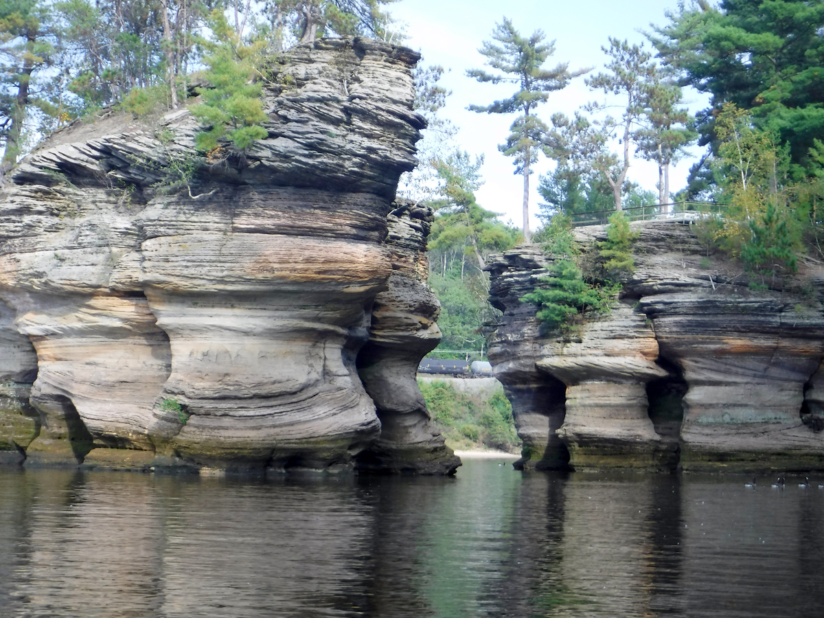
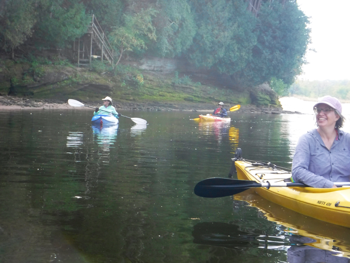
09/18/2024 – Paddle 9
The stars aligned to introduce one of our favorite paddles on the Wisconsin River (just below the dam) to our three friends. Katia had the day off, Steve was available, and Deb’s pain level was “good enough.” The weather was warm (we were seeking shade at the put-in) and the wind staved off until we were well done with the ride.
We met Steve at the Springfield Corners Park and Ride (rt 19 at 12: 7218 WI-19, Waunakee). We soon found out that Katia needed to gas up. She was sweating bullets until we ran into a Kwik Trip, now forever known as “the one we stopped at on the way to the dam”.
The Launch:
Getting into the river is a bit of a production with this paddle. There is a big hill to go down-down-down. The reward is a beautiful sandy beach. MGE sponsors this water access and last time we did the paddle, the path was paved and so nice. Unfortunately, over time the pavement eroded and it was back to being quite tricky to walk down. Steve was able to use his wheels handily but Katia’s wheels kept falling off. We don’t have wheels and just carefully carried our Kevlar canoe step-by-step to get the boat down.
While Mary and Steve shuttled a car to the end point, Katia and Jeanne got their gear down and decided to take a swim in the river. Clothes were discarded! It was pretty funny.
The paddle
The float was pretty much the typical experience and it was fun showing off our developed list of “points of interest”. We had to deal with some Duck Boat Tours but it wasn’t too bad. As it happened, they had to deal with us too – we noticed they had to wait until we were clear of some of the tighter dells rock formations.
I have to admit that I am writing this a couple of months afterwards so I’m sure I’m missing some highlights. But one thing we did experience was that “bubbly” area after passing the last formation – it acted like a mini rapids this time and was pretty fun.
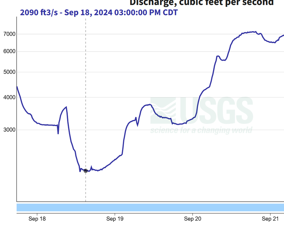 The water level was rather low. Just two days later, we had so much rain the levels skyrocketed!
We experienced a beautiful sunset while we were packing up. Since everything ran longer than expected, Steve packed up his boat and dropped everyone to get their cars so he could save time and not return back to the put in.
Waubesa Wetlands (first time) – blocked by a beaver dam
09/25/2024 – Paddle 10
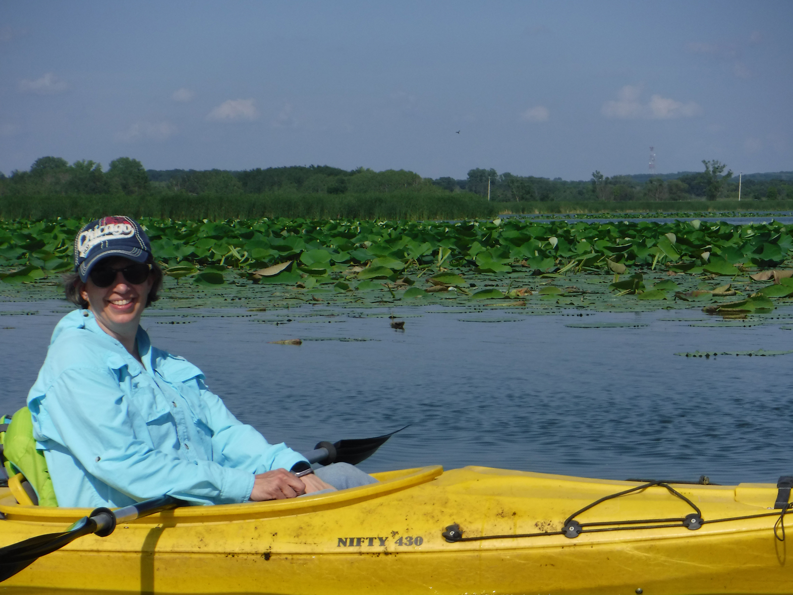
I saw on social media that a guided paddle into the Waubesa Wetlands was being offered. Ummm… Waubesa Wetlands? what is that!? We might have joined the event, but 1) the start time was in the morning, 2) it was offered to people who have never paddled, 3) we expected lots of motor boats to be on the lake on a Sunday, annnd most importantly, 4) the winds looked iffy for crossing lake Waubesa. Thus and so, on a beautiful calm weekday we decided to try it on our own – just the two of us.
The event was being offered in conjunction with the debut of a documentary about the wetlands named An Invitation to Wonder. We were able to stream the beautiful movie after we paddled in there. It is written by the grandson of someone who owns land there but is also a naturalist professor at UW. He set out to get to know the wetlands better during the pandemic. Here are a couple of links to find the movie: waubesafilm.com and wisconservation.org/waubesa-wetlands-film/ Even the trailer is so gorgeous.
The Launch
We put in at Goodland County Park (2844 Waubesa Ave. Madison) which has a boat ramp for large boats. It has facilities close by and lots of parking across the street. We met some nice people who were sad to be taking their boat out. They said the docks were being pulled out for the winter so it last ride in spite of the strange warm weather we were experiencing in Wisconsin. We talked to them about the lake a bit – it’s where they go and they loved it.
The Paddle
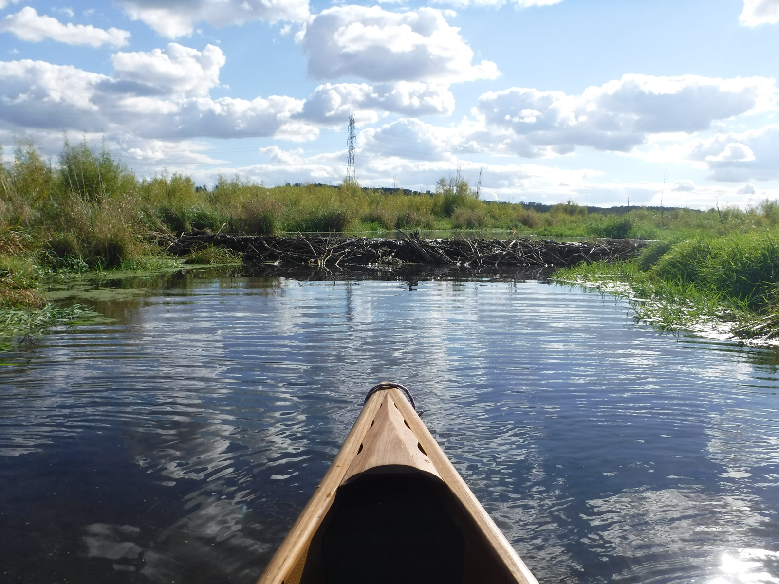
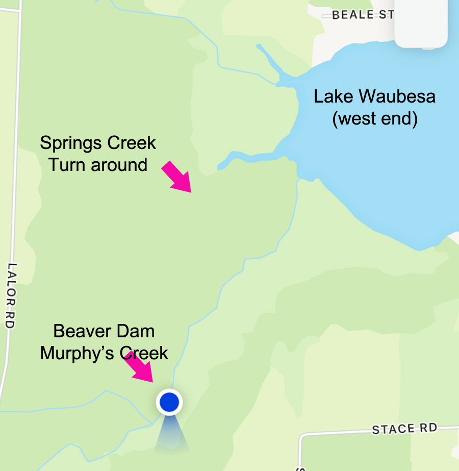
After launching we headed right. We knew we had to cross the lake and hoped no big boat would be recreating near us causing a wake – our hunch paid off. At the west end of the Lake Waubesa there are two creeks. The larger one is Murphy’s creek and to get there head for the power line tower. There was quite a bit of invasive plants to get through right before getting into the creek, but once in, the creek was okay.
It was clear water in there. We saw some heron and some cool trees. But what we didn’t expect was to be forced to turn around by a beaver dam! Although we do see beaver activity on the banks, in all the paddling we’ve done this was a first time experience. We marveled at the size of it and how the water on the opposite side of the dam was 2-3′ higher than where we were.
We turned around and retraced our steps back to Lake Waubesa. We almost skipped Springs Creek because of the energy it takes to get through mucky plants / algae but we did get into to Springs Creek. I think the water level was low – we couldn’t really get very far due to grounding. But we were getting tired and knew we had to cross back over the lake.
 Take out was the same boat ramp. There were some boys fishing on the dock and one boy was trying to get his brother to come with him back home. Then Dad came by and that fishing party was ended. heh.
Approximate itinerary
2:00 drive to Goodland County Park/ unpack
2:50 launched on Lake Waubesa
3:10 entered Murphy Creek
3:40 blocked by a beaver dam! – turned around
4:13 turn around time / explored Deep Springs creek
4:35 disembarked
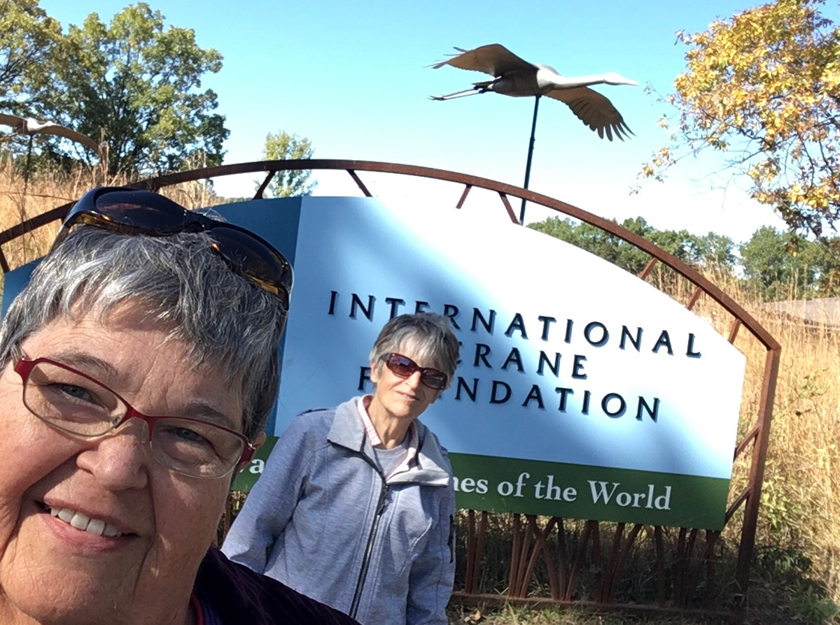
Mirror Lake after International Crane Foundation
10/09/2024 – Paddle 11
It had been awhile since we visited the International Crane Foundation even though we always keep our membership up to date. It was a beautiful fall day to walk around. We hadn’t seen the great improvements made to the facility. It was really great. They have every type of crane in the world at ICF and most of them are paired. Kind of sad to see those that are solo cranes but I guess things don’t always work out with mates. They do a lot of conservation to keep cranes from going extinct.
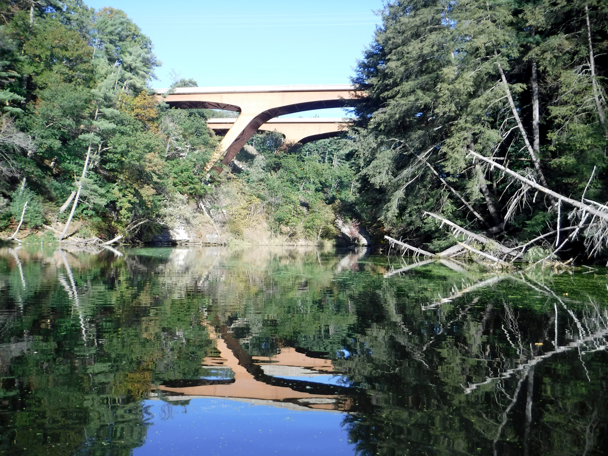
We exited at the gift shop and timed it just right to launch into Mirror Lake at Mirror Lake State Park. It takes 1.5 – 2 hours to paddle to the dam and back depending on how many nooks and crannies get explored.
There was some algae at the boat launch that almost scared us off. Sometimes the lake is pretty gross. Some people getting off the water assured us it wasn’t bad at all. We just enjoyed the beautiful day. We rarely experience large boats / wakes at Mirror lake. There are bluffs before the dam and an area that smells very piney.
Final 2024 paddle: Blackhawk Island, Wisconsin River
11/08/2024 – Paddle 12
Our last paddle was just above the dam in Wisconsin Dells.
see: 2024 Blackhawk Island Paddle