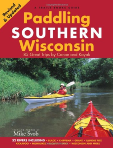
 We heavily do research on waterways before we take the time to try a new paddle. For such a long time Paddling Southern Wisconsin by Mike Svob was so heavily relied on that people just call it “the book”. You could say something like “We’re paddling mile 3-9 on page 20 of the book” and friends would know what you are talking about.
Luckily there are more resources available on the internet and new books.
So before the others – we still thank Mike Svob and continue to review the suggestions.
Here are some primary resources we use:
- USGS for water levels
- Wisconsin DNR
- Paddling Southern Wisconsin, “the book” by Mike Svob
- Canoeing and Kayaking Southern Wisconsin, Timothy Bauer’s book
- wisconsinrivertrips.com – nice photos, videos and maps
- milespaddled.com website
- riveralliance.org – their sponsored outings sparks ideas
- Friends of Starkweather creek (map)
- Friends of Turtle Creek (map)
https://www.milespaddled.com/2016/04/turtle-creek-paddle-guide/- Possible future paddle via Facebook: Turtle Creek to Macktown approximate 2 hr trip is beautiful, very quiet with no boat traffic, and mostly wooded. The river is surprisingly shallow here and the rocky bottom is often easy to see in the clear water.
- Dane County park system map includes boat launches and walking trails – use a big screen – it’s dense
- Rock River Trail
- paddle Wisconsin
- Goose Island campground / canoe trail & paddling LaCrosse area
- Upper Mississippi water trails – scroll down the page
- Lower Wisconsin River Paddle Planner – by length time to paddle (includes maps)
- We have a new page for internet recon we started during the 2020 pandemic. Places we might try in the future.
- … and many more …